


Adams 162, Adams County, Colorado
About
Outline

Summary
| Unique Area Identifier | 546227 |
| Name | Adams 162 |
| County | Adams County |
| State | Colorado |
| Area (square miles) | 3.61 |
| Land Area (square miles) | 3.59 |
| Water Area (square miles) | 0.02 |
| % of Land Area | 99.38 |
| % of Water Area | 0.62 |
| Latitude of the Internal Point | 39.98972280 |
| Longtitude of the Internal Point | -104.96207620 |
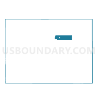
Maps


Graphs
Select a template below for downloading or customizing gragh for Adams 162, Adams County, Colorado


Neighbors
Neighoring Voting District (by Name) Neighboring Voting District on the Map
- Adams 160, Adams County, CO
- Adams 161, Adams County, CO
- Adams 163, Adams County, CO
- Broomfield 35, Broomfield County, CO
- Broomfield 36, Broomfield County, CO
- Broomfield 37, Broomfield County, CO
- Broomfield 38, Broomfield County, CO
- Weld 305, Weld County, CO
Top 10 Neighboring County Subdivision (by Population) Neighboring County Subdivision on the Map
- Brighton CCD, Adams County, CO (80,401)
- Broomfield CCD, Broomfield County, CO (55,889)
- Erie-Frederick CCD, Weld County, CO (37,786)
Top 10 Neighboring Place (by Population) Neighboring Place on the Map
Top 10 Neighboring Unified School District (by Population) Neighboring Unified School District on the Map
- Northglenn-Thornton School District 12, CO (209,792)
- St. Vrain Valley School District RE 1J, CO (151,981)
- Brighton School District 27J, CO (77,537)
- Weld County School District RE-8, CO (12,408)
Top 10 Neighboring State Legislative District Lower Chamber (by Population) Neighboring State Legislative District Lower Chamber on the Map
- State House District 48, CO (112,104)
- State House District 31, CO (100,635)
- State House District 33, CO (94,061)
Top 10 Neighboring State Legislative District Upper Chamber (by Population) Neighboring State Legislative District Upper Chamber on the Map
Top 10 Neighboring 111th Congressional District (by Population) Neighboring 111th Congressional District on the Map
Top 10 Neighboring Census Tract (by Population) Neighboring Census Tract on the Map
- Census Tract 600, Adams County, CO (4,747)
- Census Tract 314, Broomfield County, CO (2,583)
- Census Tract 313, Broomfield County, CO (1,648)
- Census Tract 612, Adams County, CO (1,294)
- Census Tract 20.05, Weld County, CO (561)